Volume III, Issue II Available for Order Now


AS A SPATIAL PRACTITIONER AND RESEARCHER, I AM OFTEN FASCINATED BY THE WAYS IN WHICH THE BUILT ENVIRONMENT IS NAVIGATED, REPRESENTED, AND CONTESTED THROUGH THE BLACK EXPERIENCE. In 2025, after completing my graduate studies in Architecture and Urban Design, I began to carry out a year-long community-engaged research project titled: Atlas of Abolitionist Urbanisms: Mapping Liberatory Socio-Spatial Practices in the Black South. This project would entail me traveling across the Black Belt to engage with Black abolitionists, New Afrikan organizers, practitioners, and researchers engaged in self-determining work. It would also serve to catalyze my development of a counter-mapping practice that could help our people build towards liberation.
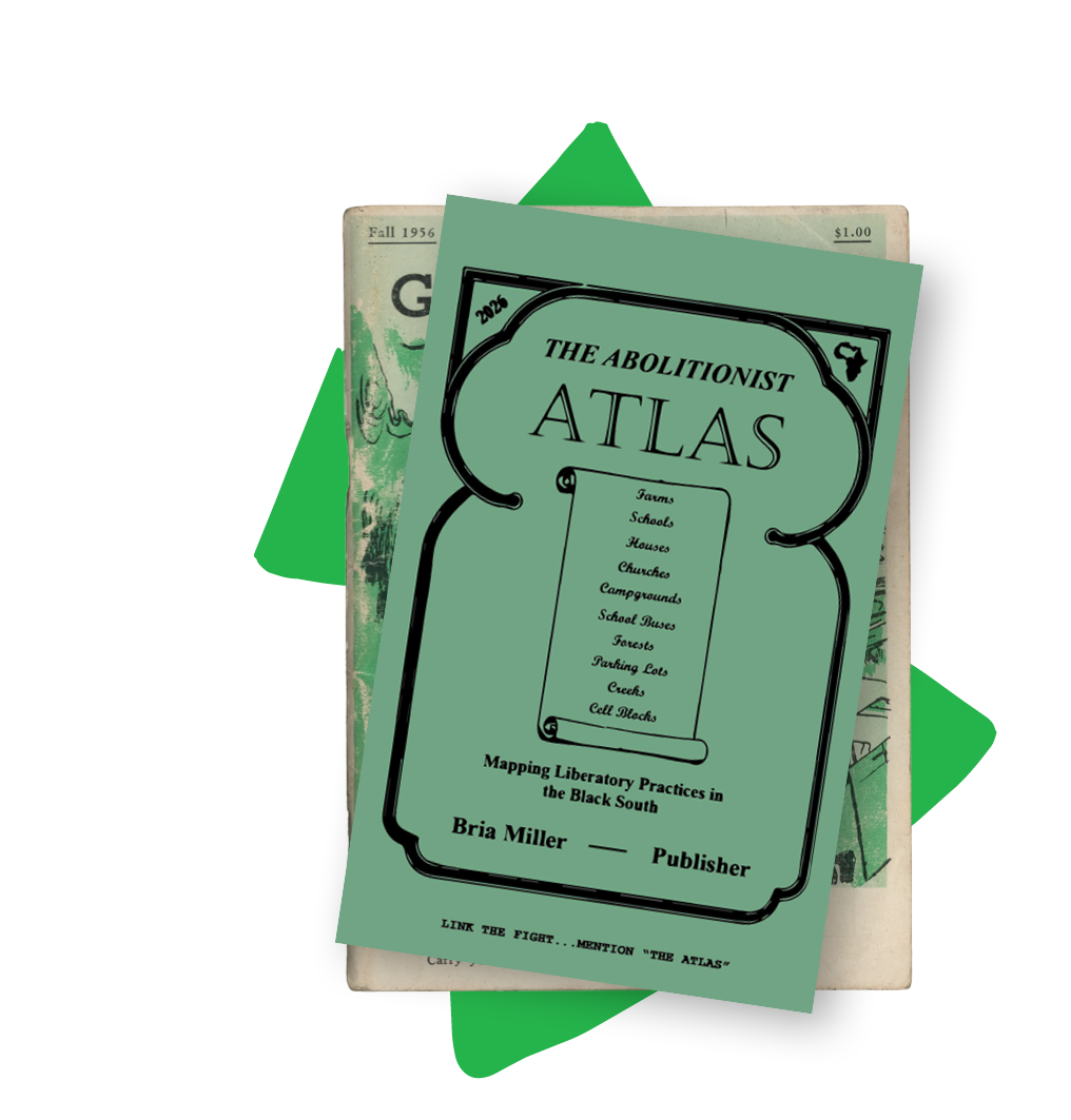
As I began to outline this project, I sought to deepen my understanding of abolition, a term often detached from the struggles for national liberation and the practical work of making revolution within the belly of the United States empire. Drawing on the work of W.E.B Du Bois, who in Black Reconstruction, theorized how post-Civil War emancipation was incomplete without the concurrent creation of new social, political, and economic structures—and contemporary thinkers who have carried this framework forward—I came to define “abolition” as both a positive and negative project.[1] One confronting systems of oppression while simultaneously building alternative institutions, infrastructures, and social relations capable of sustaining our people beyond the collapse of a capitalist-imperialist empire.
My interpretation of abolition was heavily shaped by my involvement in the New Afrikan Independence Movement (NAIM) and its commitment to the liberation of the Republic of New Afrika (RNA): the five state territory spanning Mississippi, Louisiana, Alabama, Georgia, and South Carolina, founded in 1968 in the right of self-determination for Black/New Afrikan people in the United States. Emerging from a tradition of Black nationalist and anti-colonial struggle, this movement recognizes Black people in the United States not as a racial or ethnic minority, but as colonized subjects who, collectively, constitute an oppressed nation subjugated by and confined within the United States empire. The revolutionary task of the NAIM is centered on freeing the Land, gaining independence, and building the political, economic, and social institutions necessary to sustain it. For this reason, I believe that the NAIM embodies one of the most advanced expressions of abolitionist practice in our current day. Therefore, it became both the geographic and political backdrop to the Abolitionist Atlas and its concept of New Afrikan counter-geographies.
This essay traces the development of the Abolitionist Atlas, a tool and periodical counter-mapping where and how Black/New Afrikan people are building toward self-determination in the Black Belt. The Abolitionist Atlas seeks to address the urgent need to build networked systems of knowledge and practices that connect local organizing efforts to the ultimate goal of land and independence. The project is grounded in what I call New Afrikan counter-geographies, a framework developed through the examination of how the New Afrikan Independence Movement has historically understood, organized and represented space in its pursuit to envision and build a sovereign republic beyond the confines of the United States empire. By tracing counter-geographic histories ranging from the Negro Motrorist Green Book to New Afrikan traditions of mapping, naming, and graphic representation, I will detail how the Abolitionist Atlas builds on a longer tradition of Black geographic world-making.
Counter-mapping refers to the collection, analysis, and visualization of spatial data for the purposes of challenging hegemonic power. In other words, it is a practice of making visible the people, histories, and possibilities that conventional maps often obscure, while holding space for alternative ways of navigating and imagining the world. As I began to think of ways to translate the invaluable knowledge that would be unveiled throughout my travels across the South into a physical form that could be shared, used, and built upon by others, I looked to The Negro Motorist Green Book as a key precedent for this practice.[2]
The Negro Motorist Green Book was published annually by Victor Green from 1936 to 1976. It was a travel-guide that assembled a directory of commercial establishments accommodating for Black motorists during the era of Jim Crow apartheid in the United States. While the book did not include any conventional maps, it nonetheless functioned as a form of counter-mapping by gathering and organizing Black territorial knowledge into a networked geography of mobility and survival. Victor Green was a Harlem-based postal carrier. He issued the first edition of The Negro Motorist Green Book in 1936, which was only 10 pages long and focused soley on hotels and restaurants in New York City. However, following its issue, the response was massive and Victor went on to leverage his connections among other Black postal workers to source listings from across the country. As word spread and demand grew, the book came to include listings in places like Canada, the Virgin Islands and parts of Africa.[3]
To me, the beauty of Green’s publishing practice lies in the ways that the readers became participants in the process-agents of a fugitive geography, and collectively developed a sense of authorship over a nomadic and inter-generational archive. I believe that we as Black people, then and now, consistently gravitate towards these forms of knowledge making and keeping. As a movement builder, I find it increasingly necessary that we identify creative ways to build and expand these traditions, leveraging them to develop new tools that can strengthen our collective capacity to connect, organize and advance forward our struggle for liberation. And so, my method to build and structure the Abolitionist Atlas became one which re-imagined Green’s—by crowdsourcing the knowledge and practices used by Black abolitionists and New Afrikan organizers, researchers and community practitioners engaged in self-determining work. These contributions are translated into maps, listings, and illustrations across city-specific sections of the Abolitionist Atlas, offering pathways for organizers, students, and everyday people to connect, learn, and plug into ongoing efforts.
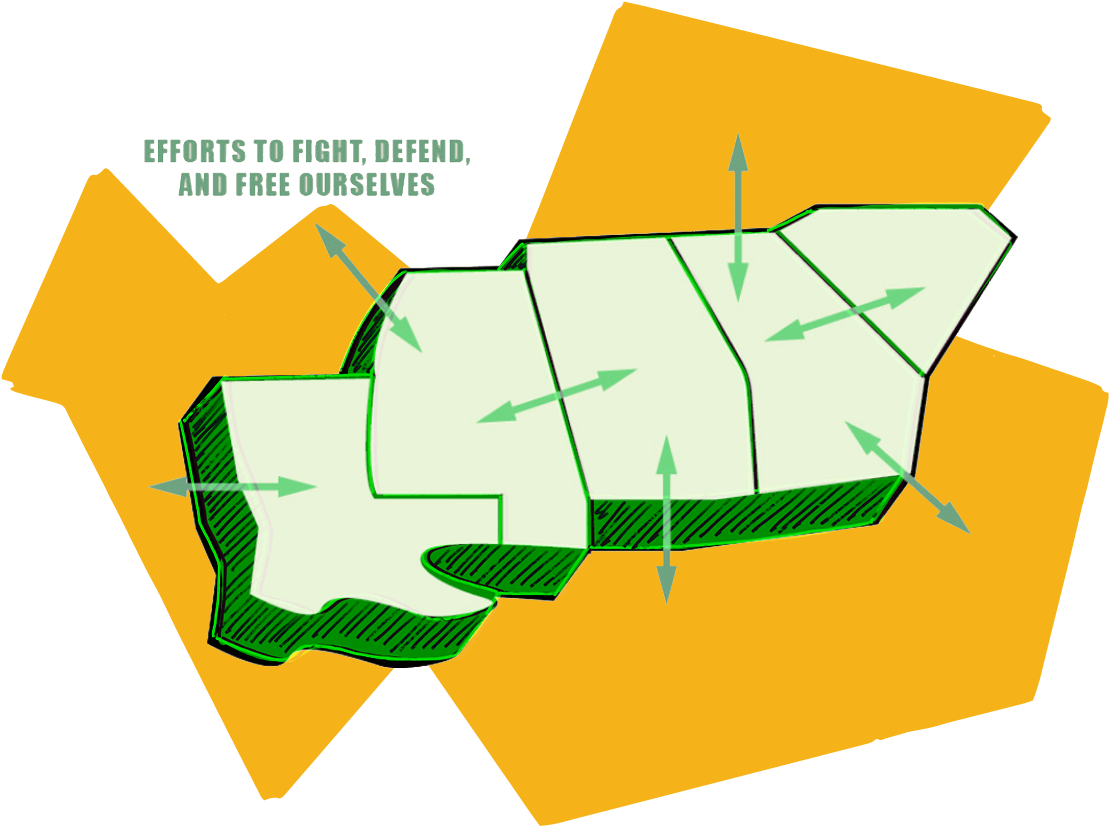
As Black/New Afrikan people in this country, our most radical pursuits of self-determination have always carried a geographic imperative at its core, one which re-shapes how space is interpreted, navigated and remade. From the practices of Maroonage established on the borderlands of colonial society, to the mapping of Black Belt counties used to argue the historical development of the Black nation and its right to self-determination, we see a persistent undercurrent of Black nationalist consciousness expressed through insurgent territorial imaginaries and practices of Black geographic world-building.
The rise of the New Afrikan Independence Movement in the late 1960s was both a continuation of, and a defining moment within, this centuries-long struggle over territory, nationhood, and self-determination. In 1963, Malcolm X grasped the essence of this by famously stating, “land is the basis of all independence.”[4] By 1968, New Afrikan freedom fighters heeding the call for an anti-colonial, land-based revolution were full throttle in a plan to assert Black people’s existence as a captive nation within the United States empire. This endeavor achieved its most complete and material expression through the founding the Republic of New Afrika and its establishment of a small but functioning government on the five Black Belt states of Mississippi, Louisiana, Alabama, Georgia, and South Carolina.
What I call a “New Afrikan counter-geography” comes from this understanding: that the landbase for this nation exists in a dual condition due to ongoing colonial oppression. On the one hand, it is captive territory, bounded and organized through the colonial geography of the United States. On the other, it is the territorial foundation upon which a sovereign future can be imagined and built. New Afrikan counter-geographies emerged from our freedom movement’s need to give liberation a definite form and direction towards where and how that new future must begin. This led the NAIM to articulate its political vision through multiple spatial dimensions: identifying the land to be liberated while reshaping popular understandings of how places were to be interpreted, named, and made meaningful for a nation of people struggling toward self-determination. Their early efforts demonstrate how these ideas were put into practice and offer the lens through which my own counter-mapping practice seeks to interpret, represent, and reimagine New Afrikan geographies of struggle in the present.
As mentioned earlier, the New Afrikan Independence Movement recognized that the struggle for state power had to proceed hand in hand with the struggle for Land. At its onset, the PG-RNA’s expedition across the national territory called for the purchase, occupation, and development of southern farmland. This early strategy would be financed through New Afrikan tax revenue, with the territory gradually expanding and defending the areas already under its control, as other pressures would force concessions from the United States government. On the Land, they sought to implement a broad range of programs including economic co-ops, New Afrikan schools, self-defense units, and other institutions that would restructure the existing communities into what was called a “New Society.” In communicating these ideas to the masses, the PG-RNA drew upon culturally understood symbols, values, and naming practices to re-shape how space and territory were to be interpreted.[5]
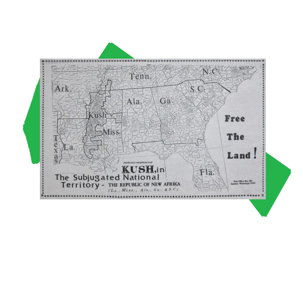
For example, New Afrikans designated the contiguous span of Black majority counties along the Mississippi Delta as the “Kush District,” invoking the ancient Nile based civilization and challenging dominant perceptions associated with the Lower Mississippi River Valley Region where the district is located. Kush would hold central importance in the steps taken toward building the New Afrikan nation-state, serving as the geographic launchpad for initiatives such as the Jackson-Kush Plan (J-K Plan). The 2008 J-K Plan, led by Malcom X Grassroots Movement and its parent the New Afrikan Peoples Organization, is an ongoing effort to build a base of autonomous power in the Black Belt region of Mississippi that will serve as the catalyst for the attainment of New Afrikan self-determination and the democratic transformation of the local economy. The PG-RNA and NAIM distributed maps which depicted Kush as the cradle of the New Afrikan nation-state, while the republic itself was mapped through a range of graphic strategies. Through shifts in scale, proximity, and orientation, these maps placed the RNA in direct relation to the Caribbean, the Gulf, and Africa. Illustrated maps drew lines of connection from the territory to other nations to frame shared histories of colonial displacement. Naming, mapping, and representation all served to convey New Afrikan territorial imaginaries reshaping how territory, belonging, and liberation could be imagined beyond the colonial geography of the United States.
WHAT I CALL A “NEW AFRIKAN COUNTER-GEOGRAPHY” COMES FROM THIS UNDERSTANDING: THAT THE LANDBASE FOR THIS NATION EXISTS IN A DUAL CONDITION DUE TO ONGOING COLONIAL OPPRESSION.
The Abolitionist Atlas emerges out of these counter-geographic histories and the material practices through which they have been enacted. It contends that the New Afrikan struggle for self-determination in the Black Belt is not a relic of a bygone political moment, but a living and breathing project—sustained through the persistent efforts to build institutions, self-sufficient structures, and decolonize the hearts and minds of Afrikan people. The opening pages of the Abolitionist Atlas therefore foreground the Republic of New Afrika as a geographic and political framework through which contemporary organizing efforts can be situated within the broader struggle for self-determination.
Over the past year, I have been traveling throughout the captive territories of Mississippi, Alabama, and Georgia, collaborating with New Afrikan community practitioners to map the knowledge and practices represented in the Abolitionist Atlas. These travels were guided by a set of research questions, designed to identify and document the organizations, institutions, and campaigns shaping abolitionist struggles across the region. The Abolitionist Atlas is organized around these questions, mapping who is doing movement work in a given place; what institutions and infrastructures they have built; and how others might connect, learn from, and contribute to these ongoing efforts. The result is a series of city-based profiles, introduced by a map, and followed by a collection of illustrations and listings that highlight the work of organizations, community practitioners, and researchers alongside local calls for support.
For example, given the history of the New Afrikan freedom struggle in the Black majority areas of Mississippi, my guiding question for Jackson became: How are New Afrikan people building toward food, water, and land justice? Prior to my first trip to Jackson, I drafted an itinerary focused on initiatives manifested through a spatial dimension, including freedom farms, community land trusts, and other efforts aimed at building collective control over land and resources. The trip was designed to immerse myself in these spaces and learn directly from organizers advancing this work. And so, during my visit, I stayed with the Cooperative Community of New West Jackson in a home rehabilitated through one of their neighborhood-based programs: A.R.I.S.E! (Acquire, Restore, Inspire, Sustain, Engage), which transforms abandoned properties and vacant lots into housing on land acquired through their community land trust. I also met with New Afrikan institutions, including Rukia Lumumba’s People’s Advocacy Institute, to learn about the broad range of programs and organizing efforts addressing community needs across the city. Following the visit, my initial scope expanded to consider mapping community grocery stores, rapid response centers, and other initiatives that address the question of where and how communities are building material self-sufficiency.
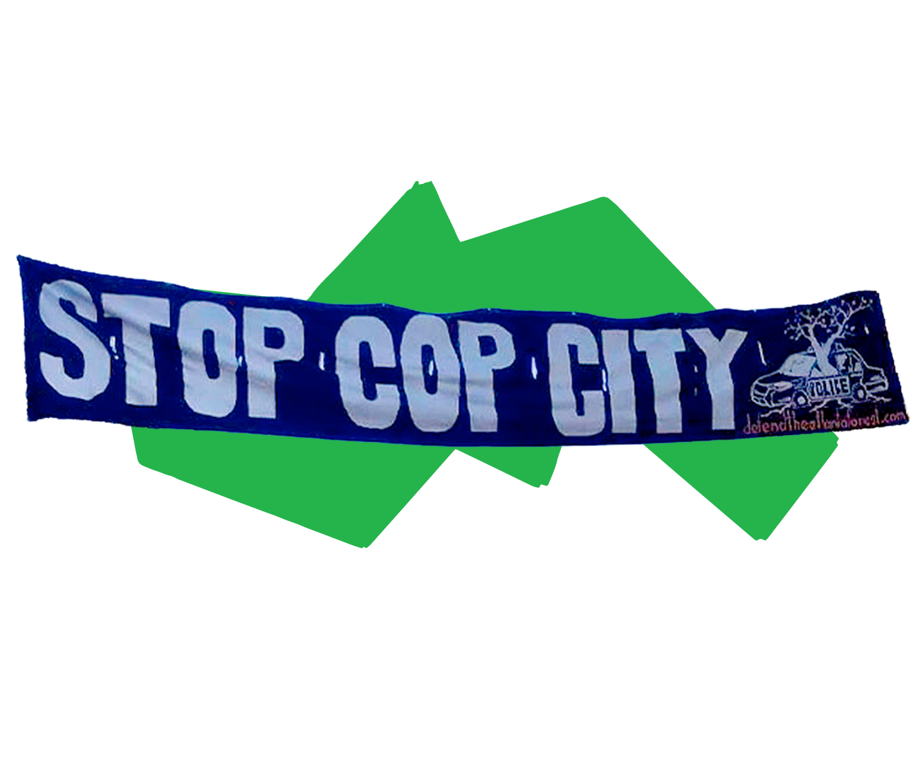
In Atlanta, Georgia the opportunity to explore a distinct, yet related terrain of struggle presented itself through the question: How are Black abolitionists confronting carceral institutions and cultivating community self-defense networks? This question emerged in relation to the insurgent and tumultuous Stop Cop City Movement, which now offers critical lessons for abolitionists struggling within the metropolitan centers of the United States empire. My visits to Atlanta were shaped by this context and brought into focus through direct engagement with abolitionist organizers. The trip was animated by a range of activities, gatherings, and site visits that offered firsthand insight into the programs being developed in a city with a deeply ingrained history of urban repression and Black misleadership that, time and time again, have led to the liquidation of mass struggle.
In a role similar to Victor Green, I relied heavily on personal networks to establish points of entry into these movement landscapes, leveraging them in my process of counter-mapping across contested geographies. The first edition of the Abolitionist Atlas represents people and places I have personally built relationships with and travelled to. And while I hope to continue that tradition in future editions of the Abolitionist Atlas, like the Negro Motorist Green Book itself, it is intended to expand through collective contribution, calling on readers to personalize their copies, circulate them within their communities, and contribute additional organizations, projects, and movement work rooted in the Deep South.
As mentioned earlier, much of our people are already inclined toward engaging with community-based, participatory practices like those embodied by the Abolitionist Atlas. It is also necessary to translate a New Afrikan point of view into visual form. And so, one does not receive a physical copy of the Abolitionist Atlas on its own, but accompanied by postcards, depicting the territory it’s traversed as a reminder of these sites not only as places of struggle but also of possibility, hope, and beauty. This sentiment is inscribed in the message on the back of these postcards, which calls on readers to use and build the Abolitionist Atlas, imprinted digitally via the QR code. I like to think of these post cards as invitations into New Afrikan counter-geographies, as they pair immersive imagery with captions and messages that offer new ways of interpreting these places and their significance in our movement work. If the postcards are the gateways, then the Abolitionist Atlas is the mapped terrain they open onto and make navigable. In the spirit of the Negro Motorist Green Book, it organizes these varied sites into a networked system oriented toward connection, study and action.
To request a free physical copy, you may send your mailing address and the number of copies you would like to receive to brialauryn.m@gmail.com. If you would like to support or stay connected to this work as it develops, you can also join the mailing list by sending your email address. Updates will include upcoming workshops and print-based materials to be distributed to support fundraising campaigns for political prisoners and other projects connected to the Abolitionist Atlas. These opportunities will also be shared through the Abolitionist Atlas’s social media channels:
Instagram: @abolitionist.atlas
Substack: @abolitionatlas
Bria Miller is an interdisciplinary designer, researcher, and organizer whose practice spans across urbanism, critical geography, and visual culture. Originally from Virginia Beach, Virginia, and now based in Austin, Texas, her work centers the ways in which the built environment is navigated, represented, and made through the Black experience. Through her New Afrikan counter-mapping practice, she publishes the Abolitionist Atlas, produces political print media, and develops maps as tools for building and coordinating the critical infrastructures that advance self-determination.


